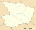
Dataja:Maine-et-Loire department location map.svg

Größe der PNG-Vorschau dieser SVG-Datei: 726 × 599 pikselow. Druhe rozeznaća: 291 × 240 pikselow | 581 × 480 pikselow | 930 × 768 pikselow | 1.240 × 1.024 pikselow | 2.481 × 2.048 pikselow | 1.279 × 1.056 pikselow.
Wersija z wyšim rozeznaćom (SVG-dataja, zakładna wulkosć: 1.279 × 1.056 pikselow, datajowa wulkosć: 389 kB)
Wersije dataje
Klikń na wěsty čas, zo by wersiju dataje w tutym času zwobraznił.
| Čas | Wobrazowy napohlad | Rozeznaće | Wužiwar | Komentar | |
|---|---|---|---|---|---|
| aktualnje | 10. februara 2018, 21:16 |  | 1.279x1.056 (389 kB) | Sting | == {{int:filedesc}} == {{Information |Description={{en|Blank administrative map of the department of Maine-et-Loire, France, as in January 2018, for geo-location purpose, with distinct boundaries for regions, departments and arro... |
Datajowe wužiwanje
Dataja so na slědowacych stronach wužiwa:
Globalne wužiwanje dataje
Slědowace druhe wikije wužiwaja tutón wobraz:
- Wužiwanje na als.wikipedia.org
- Wužiwanje na de.wikipedia.org
- Wužiwanje na eo.wikipedia.org
- Baugé-en-Anjou
- Saumur
- Angers
- Cholet
- Chemillé
- Ŝablono:Situo sur mapo Francio Maine-et-Loire
- Segré
- Baugé
- Saint-Martin-de-la-Place
- Angers-Saint-Laud (stacidomo)
- Saumur (stacidomo)
- Cholet (stacidomo)
- Angers-Maître-École (stacidomo)
- La Possonnière (stacidomo)
- La Possonnière
- Tiercé (stacidomo)
- Tiercé
- Saint-Florent-le-Vieil
- Mauges-sur-Loire
- Saint-Mathurin (stacidomo)
- Saint-Mathurin-sur-Loire
- Loire-Authion
- La Bohalle (stacidomo)
- La Bohalle
- Chalonnes (stacidomo)
- Chalonnes-sur-Loire
- Chemillé (stacidomo)
- Chemillé-en-Anjou
- Écouflant (stacidomo)
- Écouflant
- Angers-Saint-Serge (stacidomo)
- Champtocé-sur-Loire (stacidomo)
- Champtocé-sur-Loire
- Les Rosiers-sur-Loire (stacidomo)
- Les Rosiers-sur-Loire
- Gennes-Val-de-Loire
- Ingrandes-sur-Loire (stacidomo)
- Ingrandes (Maine-et-Loire)
- Ingrandes-Le Fresne sur Loire
Globalne wužiwanje tuteje dataje pokazać


