Dataja:Lebanon location map Topographic.png

Wersija z wyšim rozeznaćom (993 × 1.142 pikselow, wulkosć dataje: 990 kB, typ MIME: image/png)
Zjeće
| Pozicija kamery | | Tónle a dalše wobrazy pola: OpenStreetMap |
|---|
| wopis |
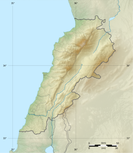
Deutsch: Positionskarte des Libanon
Quadratische Plattkarte, N-S-Streckung 115 %. Geographische Begrenzung der Karte: Français : Carte physique vierge du Liban, destinée à la géolocalisation.
Projection equirectangulaire, N/S stretching 115 %. Limites géographiques de la carte: English: Location map of Lebanon
Equirectangular projection, N/S stretching 115 %. Geographic limits of the map:
|
||
| datum | |||
| žórło |
Topographic background map: Own work
|
||
| awtor | Vivepat and NordNordWest | ||
| dowolnosć (dalewužiwanje tuteje dataje) |
|
||
| druhe wersije tuteje dataje |
|


Licencowanje

|
Es ist erlaubt, die Datei unter den Bedingungen der GNU-Lizenz für freie Dokumentation, Version 1.2, veröffentlicht von der Free Software Foundation, zu kopieren, zu verbreiten und/oder zu modifizieren; es gibt keine unveränderlichen Abschnitte, keinen vorderen und keinen hinteren Umschlagtext.
Der vollständige Text der Lizenz ist im Kapitel GNU-Lizenz für freie Dokumentation verfügbar. |
1.2 jenož |
|
|
Es ist erlaubt, die Datei unter den Bedingungen der GNU-Lizenz für freie Dokumentation, Version 1.3 oder einer späteren Version, veröffentlicht von der Free Software Foundation, zu kopieren, zu verbreiten und/oder zu modifizieren; es gibt keine unveränderlichen Abschnitte, keinen vorderen und keinen hinteren Umschlagtext.
Der vollständige Text der Lizenz ist im Kapitel GNU-Lizenz für freie Dokumentation verfügbar. |
If this file is eligible for relicensing, it may also be used under the Creative Commons Attribution-ShareAlike 3.0 license. The relicensing status of this image needs to be manually reviewed by an experienced user. You can help.
|
Wersije dataje
Klikń na wěsty čas, zo by wersiju dataje w tutym času zwobraznił.
| Čas | Wobrazowy napohlad | Rozeznaće | Wužiwar | Komentar | |
|---|---|---|---|---|---|
| aktualnje | 22. junija 2017, 08:17 | | 993x1.142 (990 kB) | Vivepat | correction lat/lon |
| 22. junija 2017, 08:10 |  | 993x1.142 (990 kB) | Vivepat | Lattitude error correction | |
| 22. junija 2017, 07:59 |  | 993x1.142 (990 kB) | Vivepat | update of the map using the Wikipedia maps conventions | |
| 16. junija 2012, 00:12 |  | 1.581x1.818 (3,35 MB) | Dr Brains |
Datajowe wužiwanje
Dataja so na slědowacych stronach wužiwa:
Globalne wužiwanje dataje
Slědowace druhe wikije wužiwaja tutón wobraz:
- Wužiwanje na als.wikipedia.org
- Wužiwanje na an.wikipedia.org
- Wužiwanje na ar.wikipedia.org
- Wužiwanje na arz.wikipedia.org
- Wužiwanje na ast.wikipedia.org
- Wužiwanje na az.wikipedia.org
- Wužiwanje na bn.wikipedia.org
- Wužiwanje na bs.wikipedia.org
- Wužiwanje na ca.wikipedia.org
- Wužiwanje na ceb.wikipedia.org
- Wužiwanje na ce.wikipedia.org
- Wužiwanje na cs.wikipedia.org
- Wužiwanje na da.wikipedia.org
- Wužiwanje na el.wikipedia.org
- Wužiwanje na en.wikipedia.org
Globalne wužiwanje tuteje dataje pokazać