Dataja:East Germany 1956-1990.svg

Größe der PNG-Vorschau dieser SVG-Datei: 450 × 456 pikselow. Druhe rozeznaća: 237 × 240 pikselow | 474 × 480 pikselow | 758 × 768 pikselow | 1.011 × 1.024 pikselow | 2.021 × 2.048 pikselow.
Wersija z wyšim rozeznaćom (SVG-dataja, zakładna wulkosć: 450 × 456 pikselow, datajowa wulkosć: 474 kB)
Zjeće


.svg)
.svg)
.svg)
.svg)
.svg)


.svg)
.svg)
.svg)


.png)
.png)


.svg)


.svg)

.svg)


.svg)
.svg)
.svg)
.svg)


.svg)
.png)


.svg)


.svg)
.svg)


.svg)


.svg)


.svg)
.svg)
.svg)
.svg)
.svg)
.svg)
.svg)
_cropped.svg)
.svg)
.svg)
.svg)
.svg)
.svg)
.svg)
.svg)
.svg)
.svg)
.svg)
.svg)
.svg)
.svg)
.svg)
.svg)
.svg)
.svg)
.svg)
.svg)
.svg)
.svg)
.svg)
.svg)
.svg)
.svg)
.svg)
.svg)
.svg)
.svg)
.svg)
.svg)
.svg)
.svg)
.svg)
.svg)
.svg)
.svg)
.svg)
.svg)
.svg)
.svg)
.svg)
.svg)
.svg)
.svg)
| Dieses Bild wurde digital nachbearbeitet. Das Originalbild kann hier eingesehen werden: Blank map of Europe 1956-1990.svg:
|
Licencowanje
Ja, awtor tutoho dźěła, wozjewjam je z tym pod slědowacej licencu:
Tuta dataja je pod licencu Creative Commons Attribution-Share Alike 3.0 Unported licencowana
- Směš:
- zhromadnje wužiwać – dźěło kopěrować, rozšěrić a dale dać
- změšeć – zo by dźěło přiměrił
- Pod slědowacymi wuměnjenjemi:
- připokazanje – Dyrbiš informacije wo awtorstwje podać, wotkaz k icency přidać a podać, kotre změny sće přewjedł. Móžeće to na přihódne wašnje činić, ale nic tak, zo zaćišć nastawa, zo licencudawar was abo waše wužiwanje podpěruje.
- dźělić – Jeli tute dźěło měnješ, přetworjuješ abo na njo natwarješ, móžeš hotowe dźěło jenož pod samsnej abo podobnej licencu kaž tuta rozšěrić.
Originalny protokol nahraćow
This image is a derivative work of the following images:
- File:Blank_map_of_Europe_1956-1990.svg licensed with Cc-by-sa-3.0
- 2011-10-30T04:43:42Z Alphathon 450x456 (485146 Bytes) == {{int:filedesc}} == {{Information |Description={{en|Blank map of Europe showing national borders as they stood from 1956-1990.}} |Source=*[[:File:Blank_map_of_Europe.svg|]] |Date=2011-10-30 04:42 (UTC) |Author=*[[:File:Bla
Wersije dataje
Klikń na wěsty čas, zo by wersiju dataje w tutym času zwobraznił.
| Čas | Wobrazowy napohlad | Rozeznaće | Wužiwar | Komentar | |
|---|---|---|---|---|---|
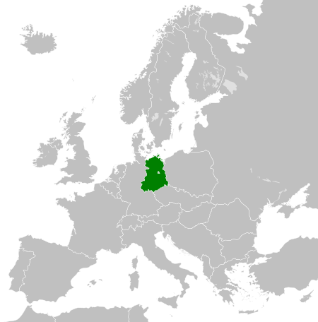
| aktualnje | 26. nowembra 2011, 02:33 | | 450x456 (474 kB) | StalwartUK | == {{int:filedesc}} == {{Information |Description={{en|Map of the East Germany (German Democratic Republic) as it was from 1949-1990. Surrounding countries accurate from 1956-1990.}} |Source=*[[:File:Blank_map_of_Europe_1956-1990.svg| |
Datajowe wužiwanje
Dataja so na slědowacych stronach wužiwa:
Globalne wužiwanje dataje
Slědowace druhe wikije wužiwaja tutón wobraz:
- Wužiwanje na af.wikipedia.org
- Wužiwanje na am.wikipedia.org
- Wužiwanje na an.wikipedia.org
- Wužiwanje na ar.wikipedia.org
- Wužiwanje na ast.wikipedia.org
- Wužiwanje na azb.wikipedia.org
- Wužiwanje na az.wikipedia.org
- Wužiwanje na ba.wikipedia.org
- Wužiwanje na be.wikipedia.org
- Wužiwanje na bs.wikipedia.org
- Wužiwanje na ca.wikipedia.org
- Wužiwanje na ce.wikipedia.org
- Wužiwanje na cs.wikipedia.org
- Wužiwanje na de.wikipedia.org
- Wužiwanje na de.wiktionary.org
- Wužiwanje na diq.wikipedia.org
- Wužiwanje na el.wikipedia.org
- Wužiwanje na en.wikipedia.org
- Wužiwanje na en.wiktionary.org
- Wužiwanje na eo.wikipedia.org
- Wužiwanje na es.wikipedia.org
- Wužiwanje na es.wiktionary.org
- Wužiwanje na eu.wikipedia.org
- Wužiwanje na ext.wikipedia.org
- Wužiwanje na fa.wikipedia.org
- Wužiwanje na fi.wikipedia.org
- Wužiwanje na fr.wikipedia.org
- Wužiwanje na fr.wiktionary.org
- Wužiwanje na ga.wikipedia.org
- Wužiwanje na gd.wikipedia.org
- Wužiwanje na gl.wikipedia.org
- Wužiwanje na gv.wikipedia.org
- Wužiwanje na he.wikipedia.org
- Wužiwanje na hi.wikipedia.org
- Wužiwanje na hr.wikipedia.org
- Wužiwanje na hr.wiktionary.org
- Wužiwanje na hu.wikipedia.org
- Wužiwanje na hy.wikipedia.org
- Wužiwanje na ia.wikipedia.org
- Wužiwanje na id.wikipedia.org
- Wužiwanje na is.wikipedia.org
- Wužiwanje na it.wikipedia.org
- Wužiwanje na ja.wikipedia.org
Globalne wužiwanje tuteje dataje pokazać